Cairo’s Free Space 2020: A Break from the Dense City

Source date:

Cairo’s Free Space’s 2020 vision imagines a break within the dense city, where the Nile and surrounding buildings help tell Cairo’s layered urban story.

Cairo’s Free Space is a 2020 architectural vision described as ‘A Break in the dense City’. The proposal begins with Cairo’s interwoven buildings, histories and cultures, then asks how an open break space might allow that surrounding urban story to be experienced.

The city as a historical mural

The original description reads Cairo through its fabric of buildings. Together, those buildings are understood as a record of the civilizations, cultures and events that have shaped the city. The concept therefore gives the existing surroundings an active role in the proposed spatial experience.

A break space offers a point from which that fabric can be encountered. Its architectural purpose is connected with how the city is read, rather than with the addition of another competing landmark.

The Nile within Cairo’s shared experience

The source places the Nile at the center of its narrative. It describes people of different classes, religions, ideas and reasons for visiting meeting in relation to the river. In the project’s vision, that diversity is part of Cairo’s character as a welcoming city.

Making room to pause

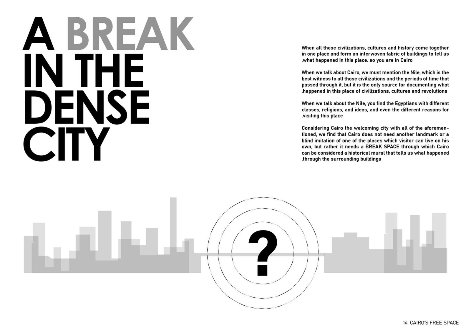
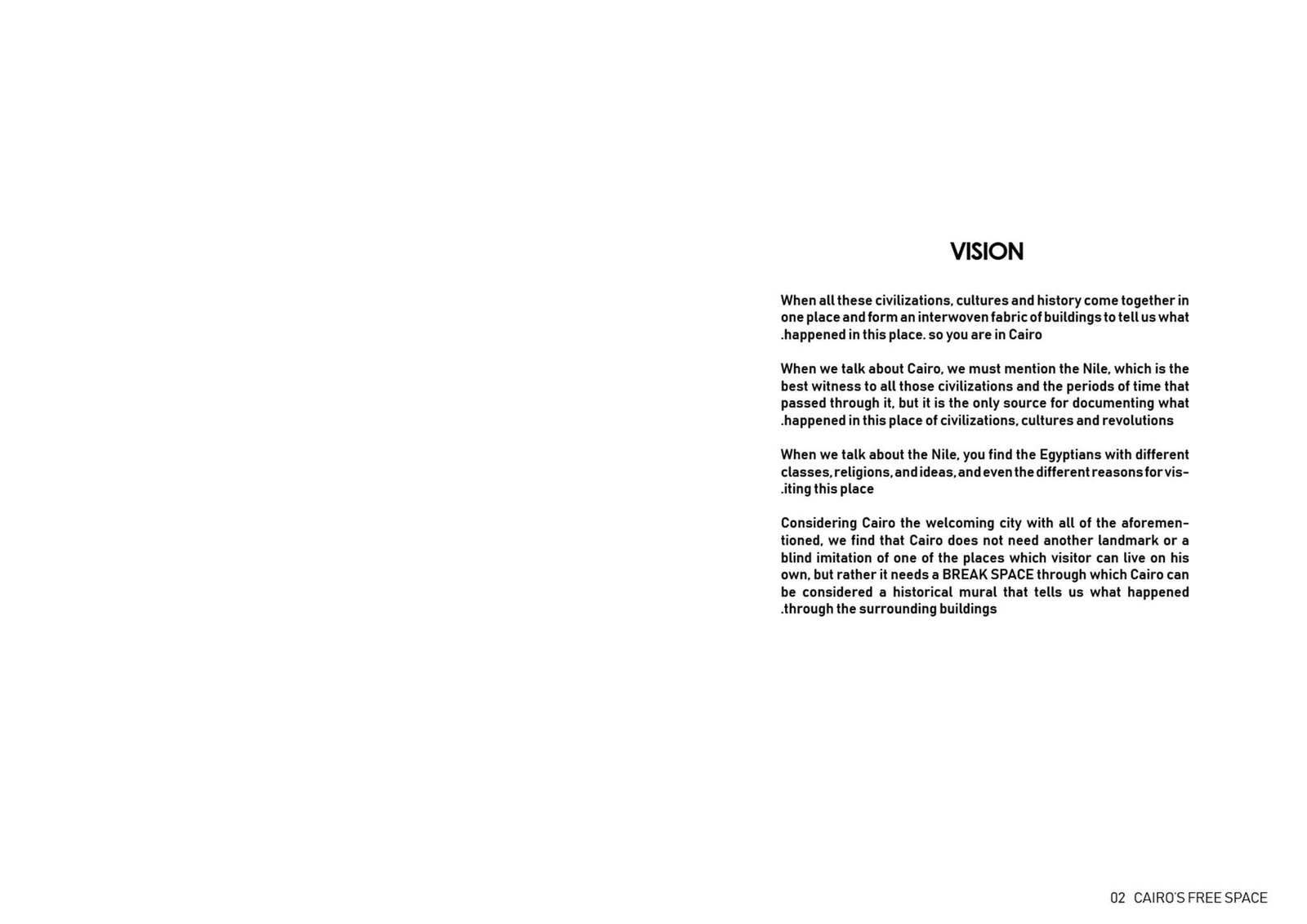
The proposal calls for a ‘BREAK SPACE’ through which surrounding buildings can be perceived as a historical mural. This places the act of pausing at the heart of the concept. An open interval becomes a way to direct attention back toward the city and the relationships already present in it.

A 2020 urban-space vision

Cairo’s Free Space develops an architectural argument about presence, memory and shared urban experience. Its stated ambition is to create room within the dense city so that Cairo’s existing fabric can tell its story. The publication records that concept and its 2020 project designation, without establishing a completed public-space intervention.
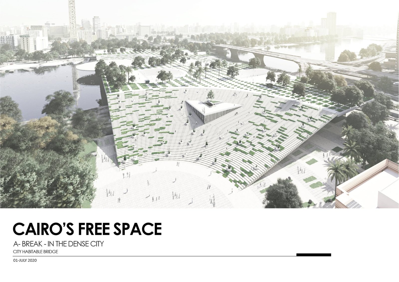
Cover presentation for Cairo's Free Space with a planted public platform beside the Nile.
Vision statement slide for Cairo's Free Space, describing a break within the dense city.
Location title slide identifying the Nile in downtown Cairo.
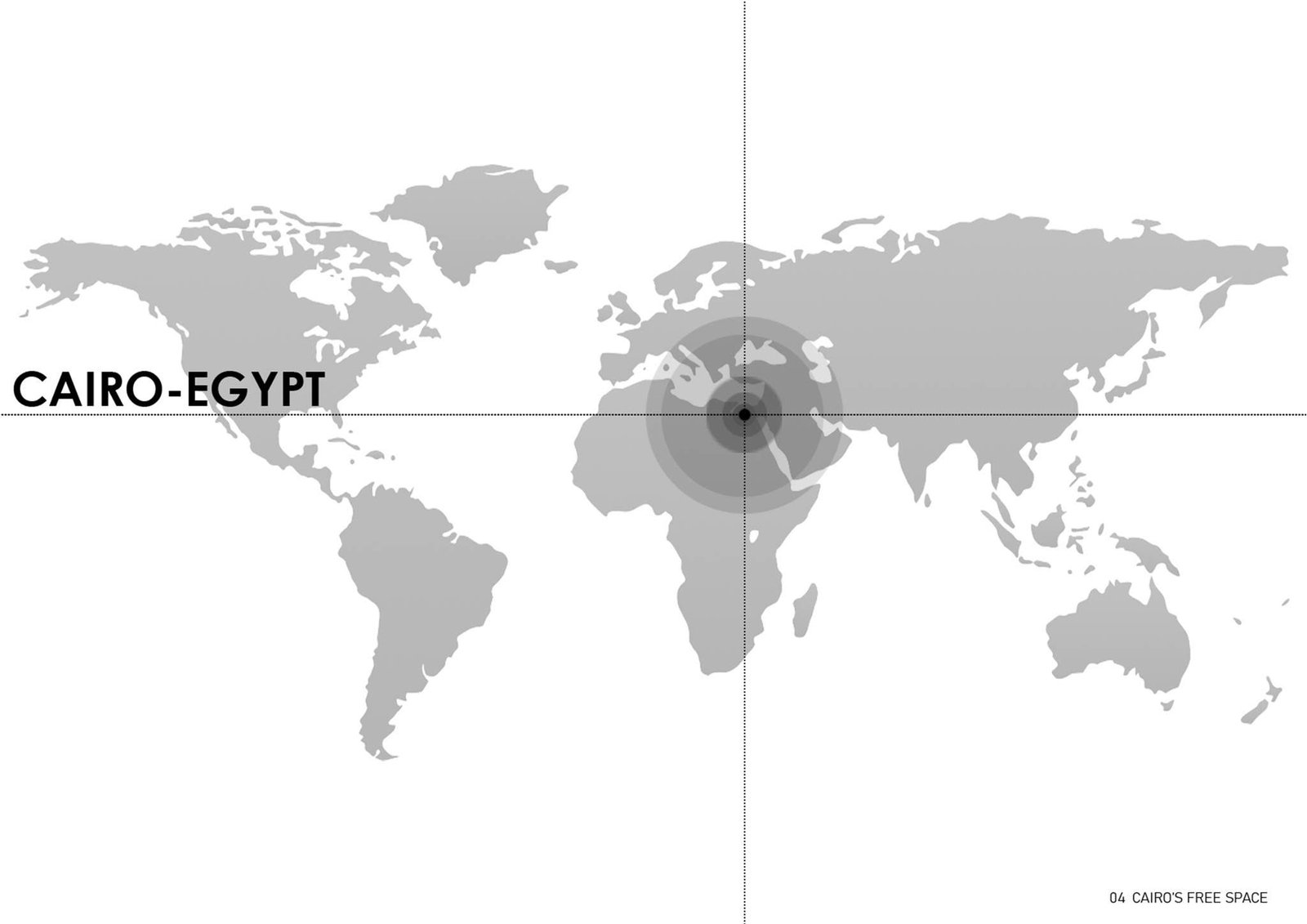
World map locating Cairo in Egypt for the public-space project.
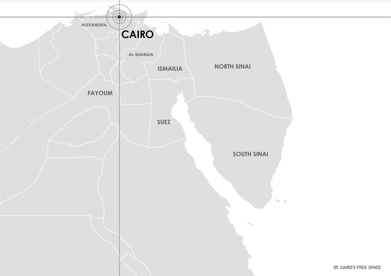
Regional map identifying Cairo and surrounding Egyptian governorates.
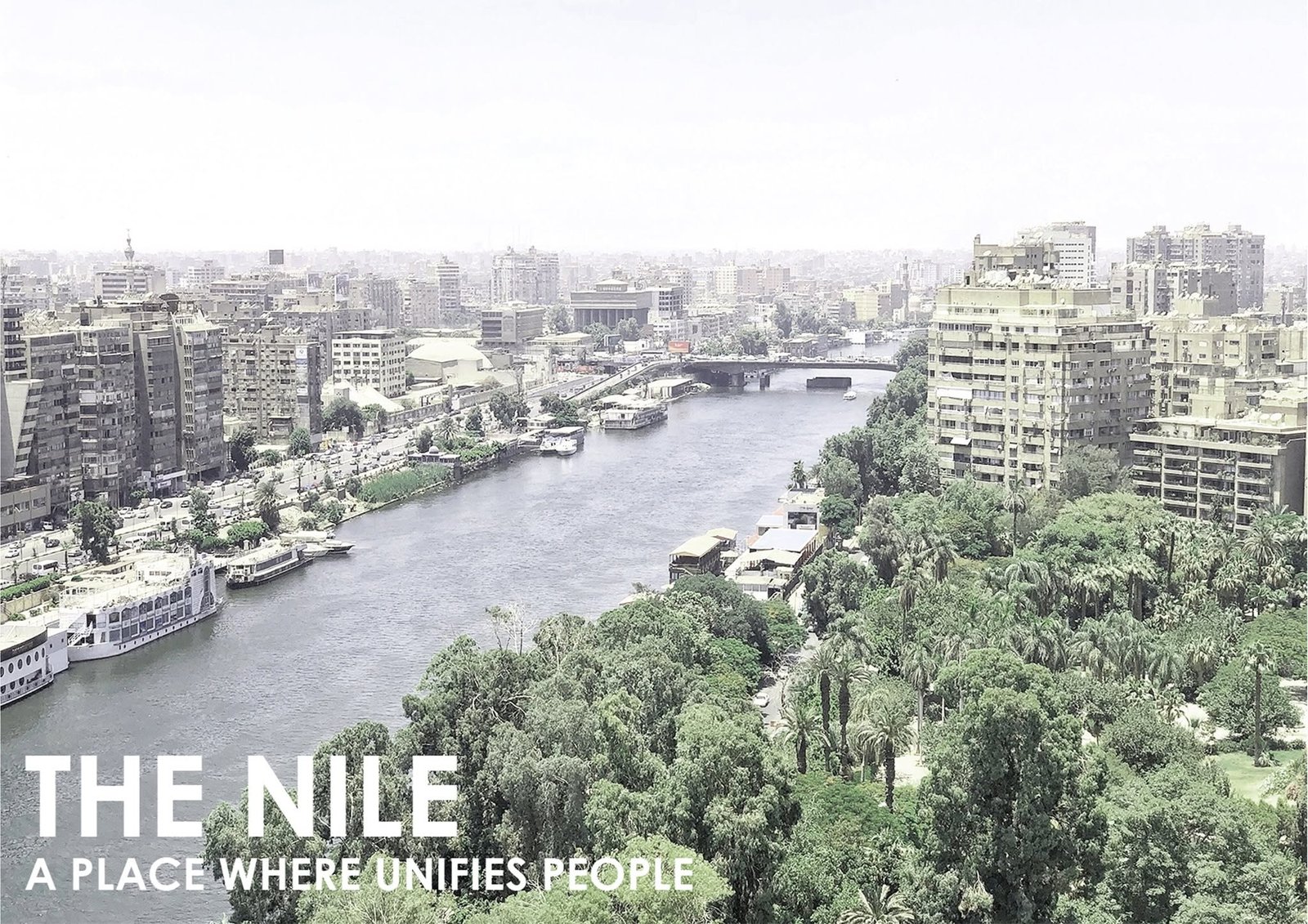
Photograph of the Nile, riverbank greenery and central Cairo buildings.
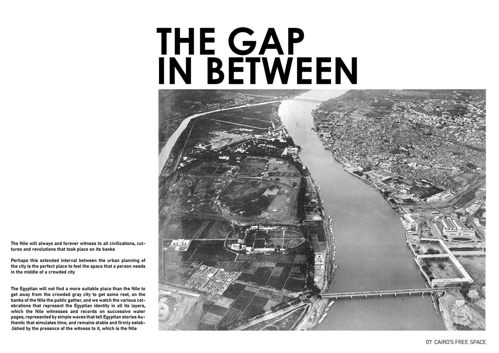
Black-and-white aerial river photograph on a slide about the gap between city edges.
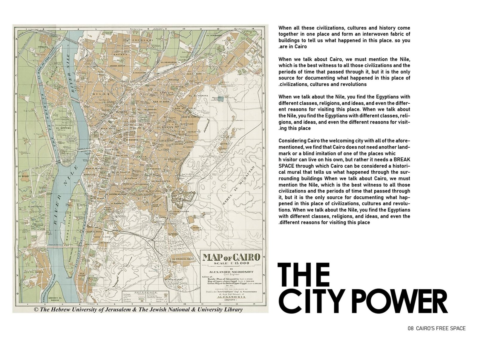
Historical Cairo map alongside the presentation discussion of urban character.
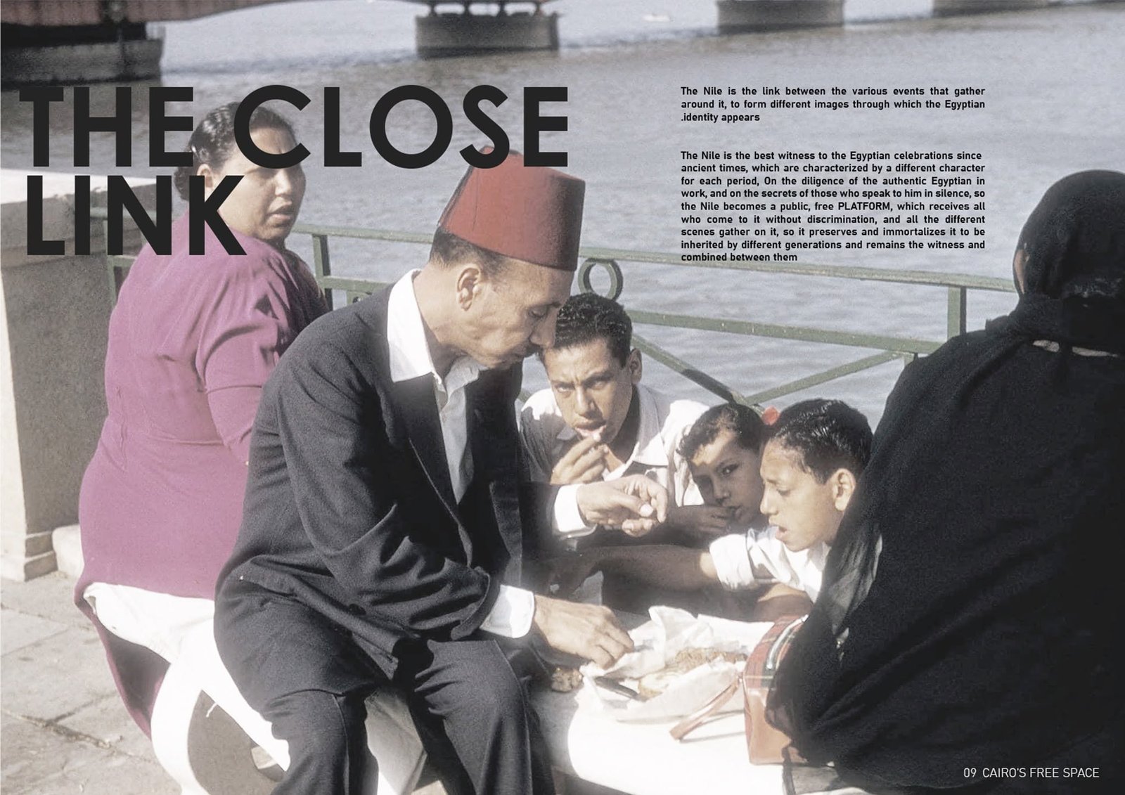
Historical group photograph on a slide about the close relationship between Cairo and the Nile.
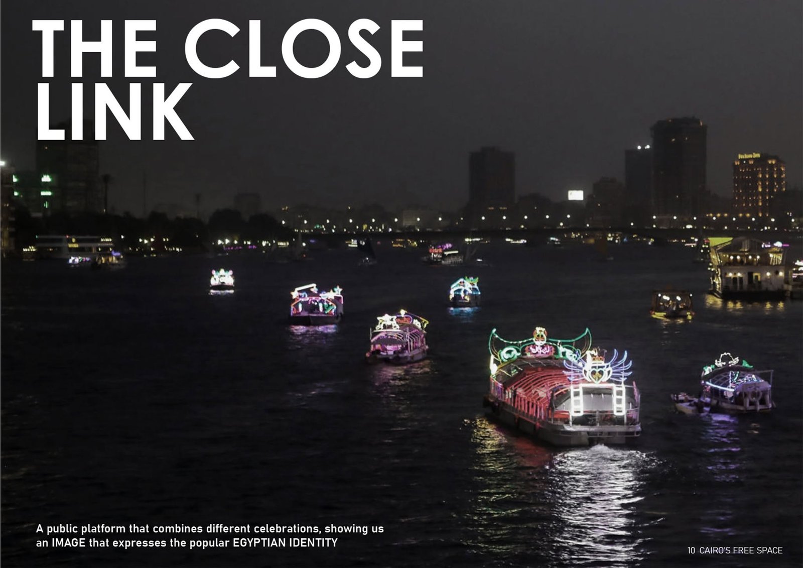
Night photograph of illuminated boats on the Nile in the public-space presentation.
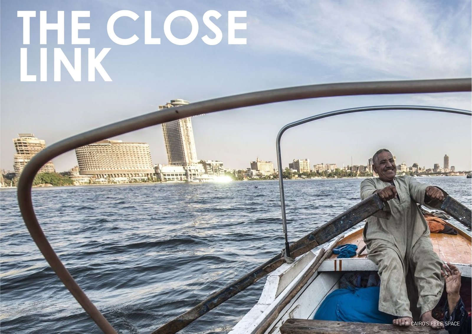
Riverboat photograph looking toward Cairo buildings across the Nile.
Philosophy title slide introducing the Nile public-space concept.
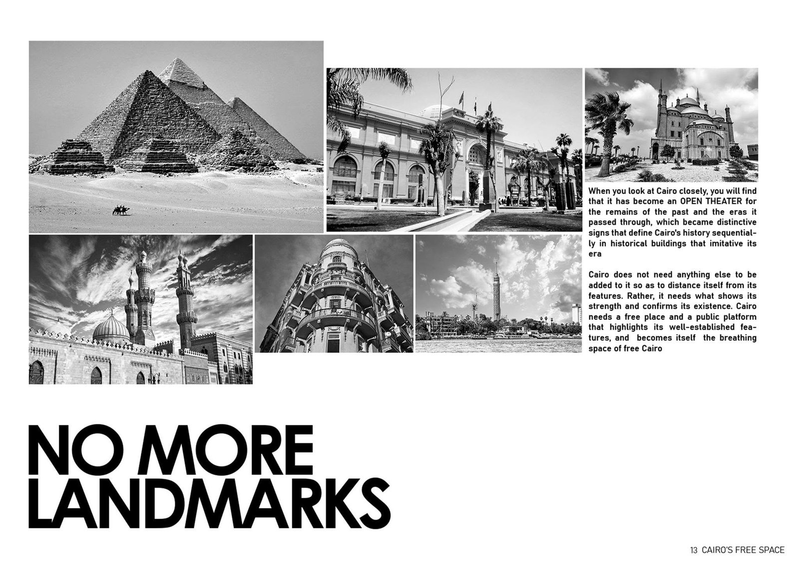
Collage of Egyptian landmarks on a slide proposing a different kind of city space.
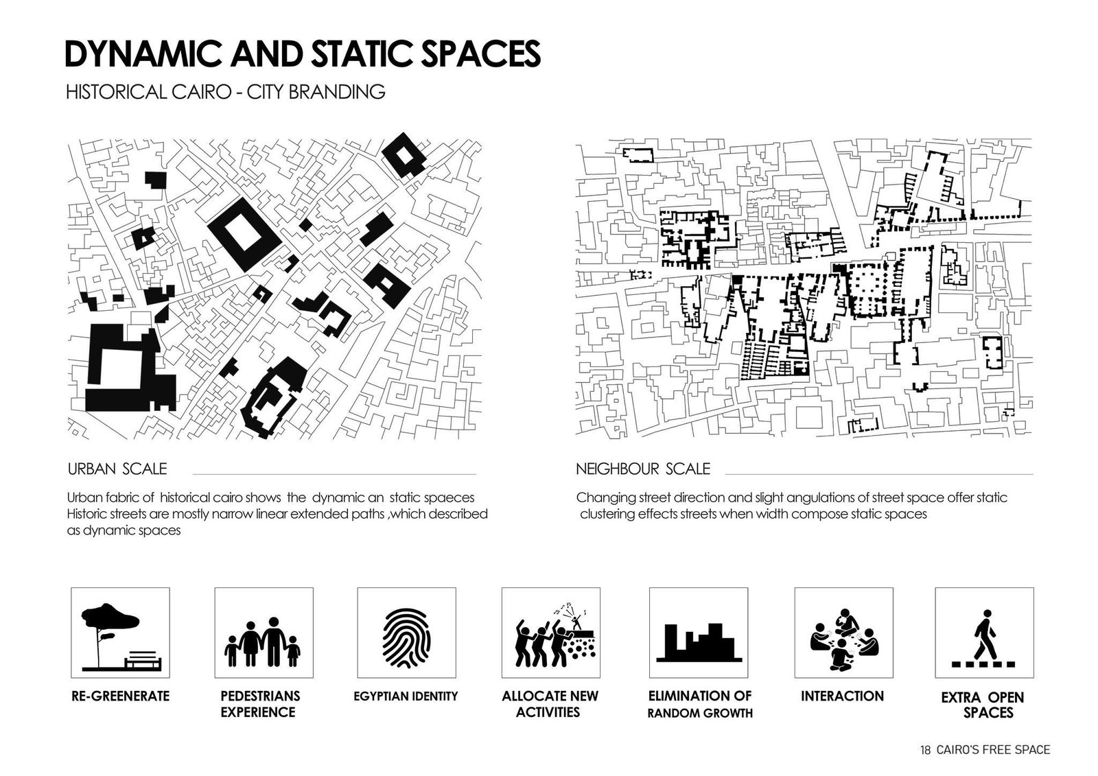
Urban-analysis diagrams comparing dynamic and static spaces at city and neighbourhood scales.
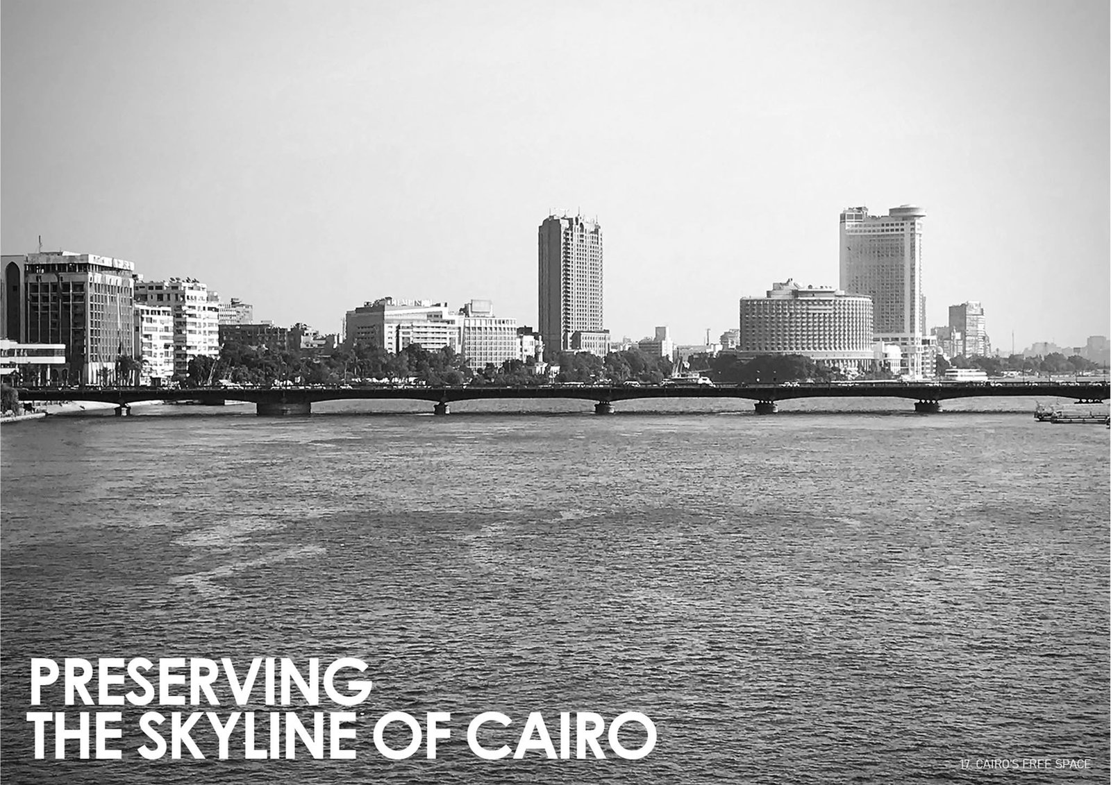
Black-and-white Nile riverbank photograph illustrating the existing Cairo skyline.
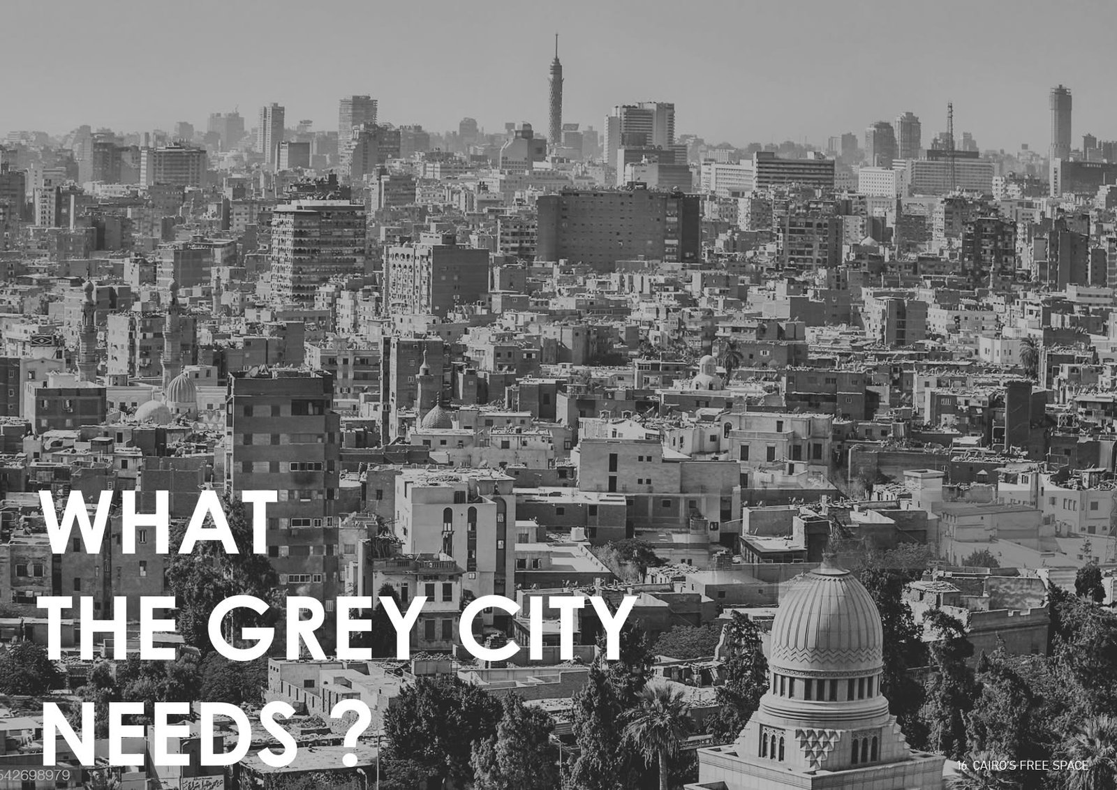
Dense Cairo cityscape photograph on a slide considering the need for open space.
Concept statement slide describing a break within the dense city.
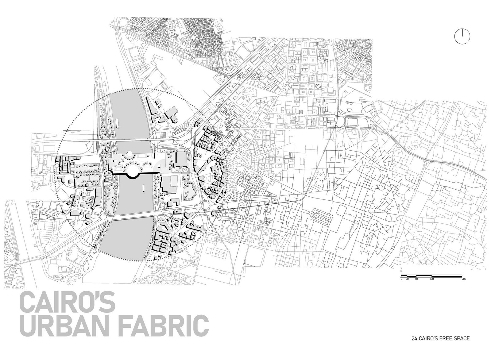
Urban-fabric map showing the Nile, city blocks and the project context.
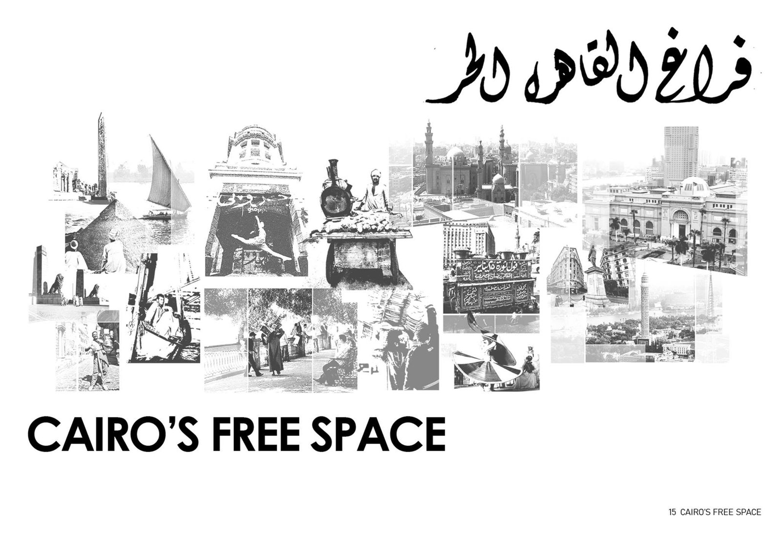
Collage of Cairo buildings and cultural references introducing Cairo's Free Space.
Form-generation title slide for the Nile public-space project.
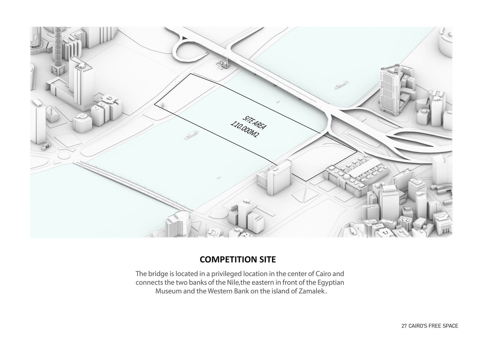
Axonometric city model identifying the competition site across the Nile.
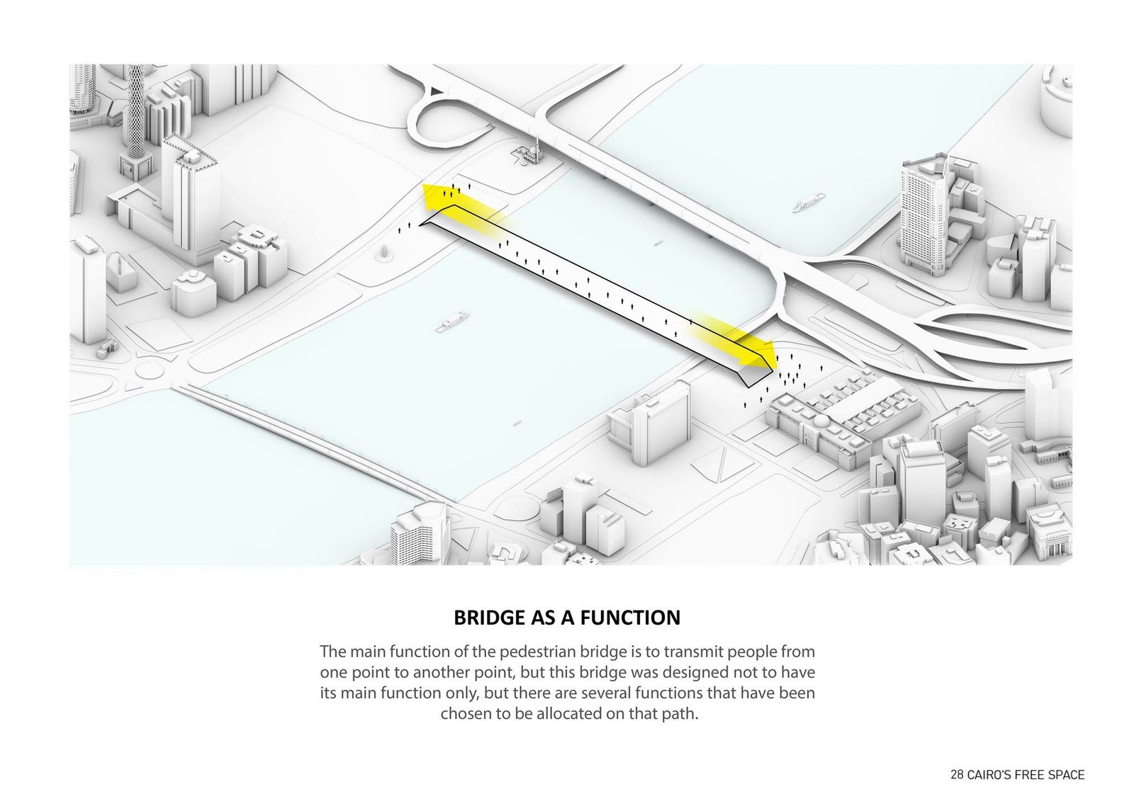
Form-generation diagram showing the bridge connection highlighted in yellow.
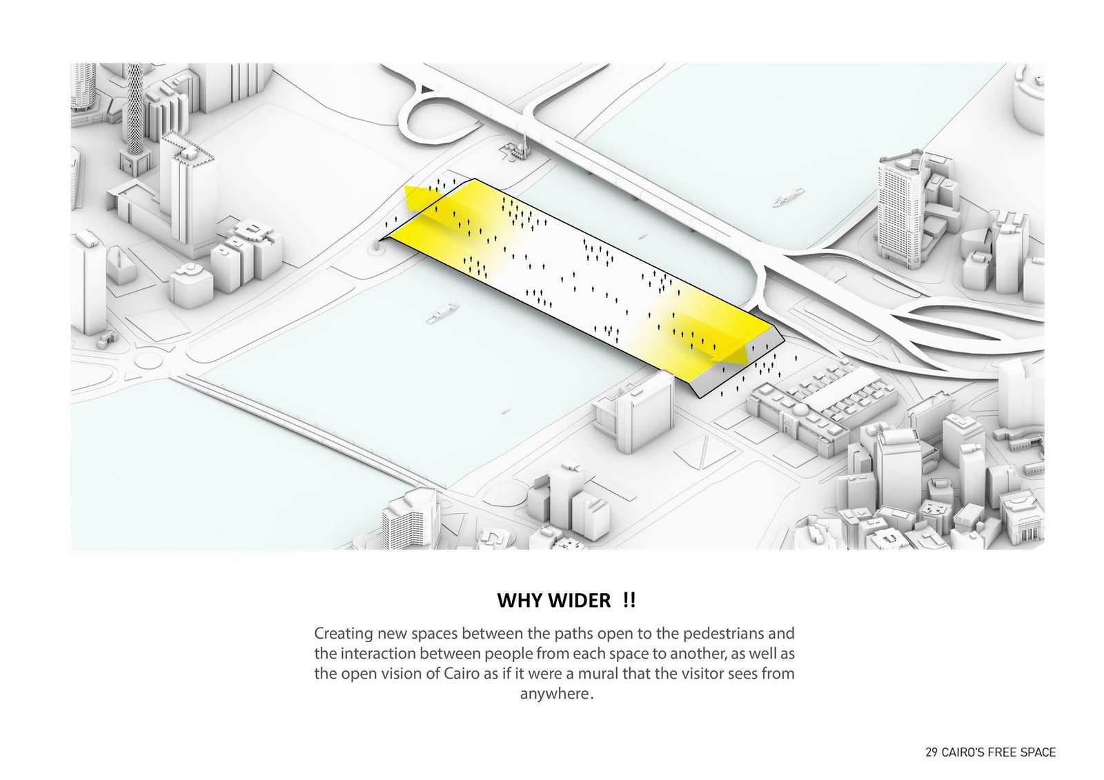
Form-generation diagram widening the public bridge surface at each end.
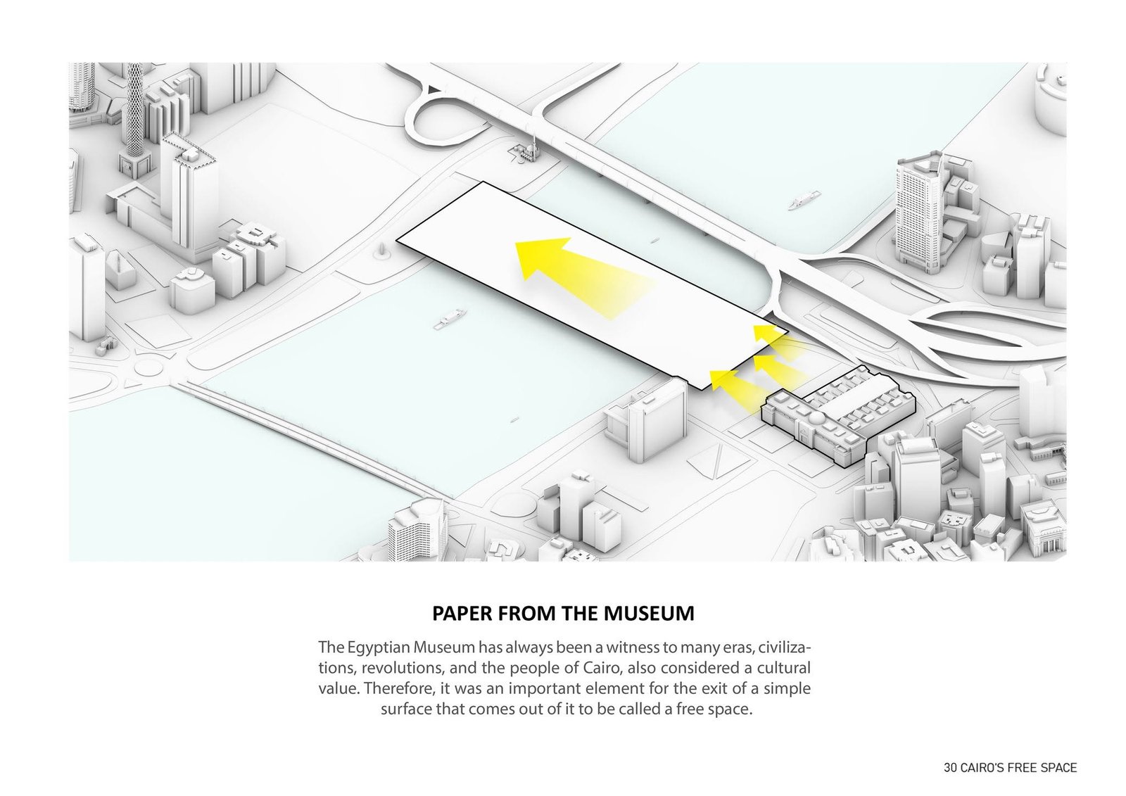
Form-generation diagram showing a folded surface extending from the museum edge.
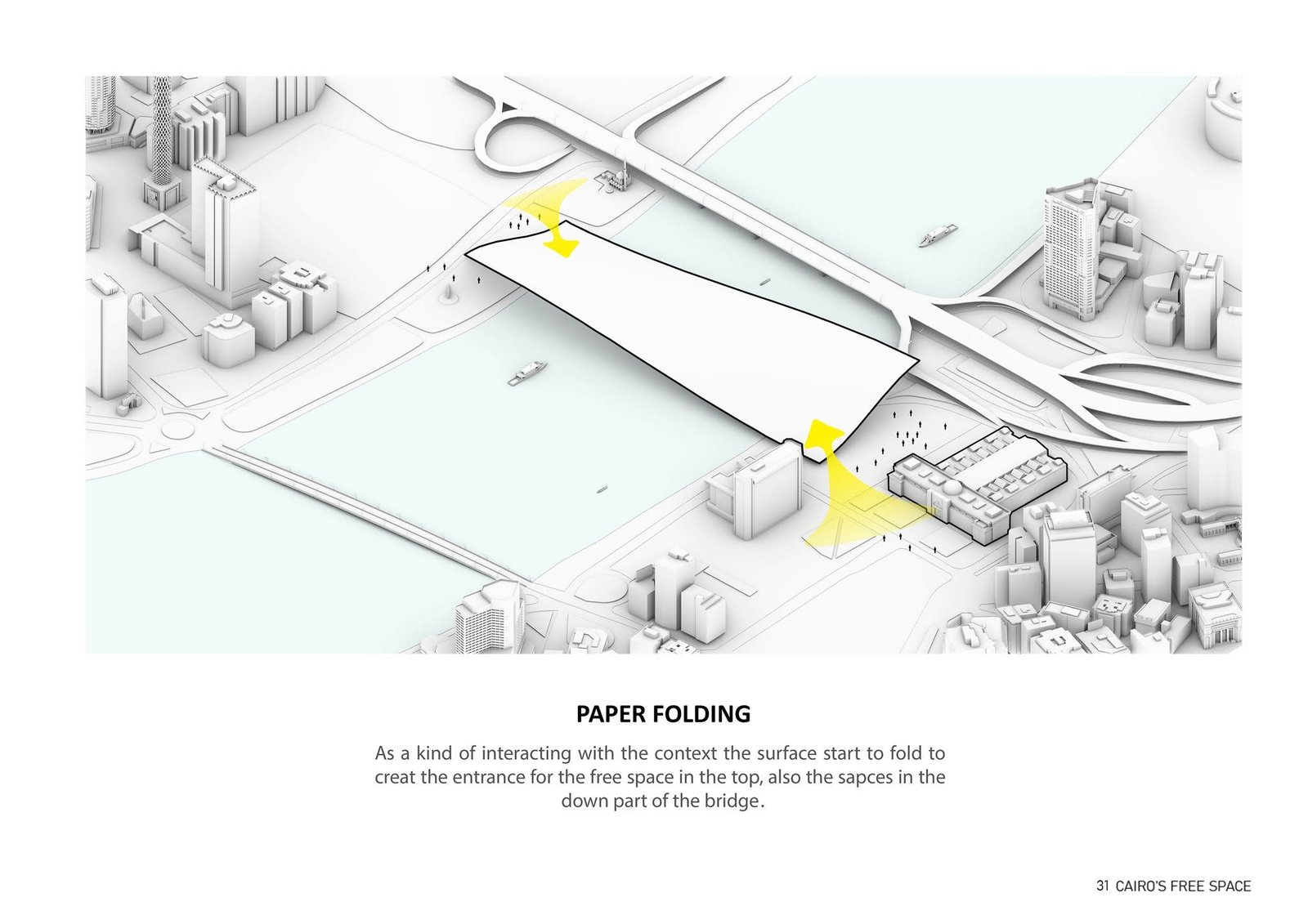
Paper-folding concept diagram showing connections between the platform and riverbanks.
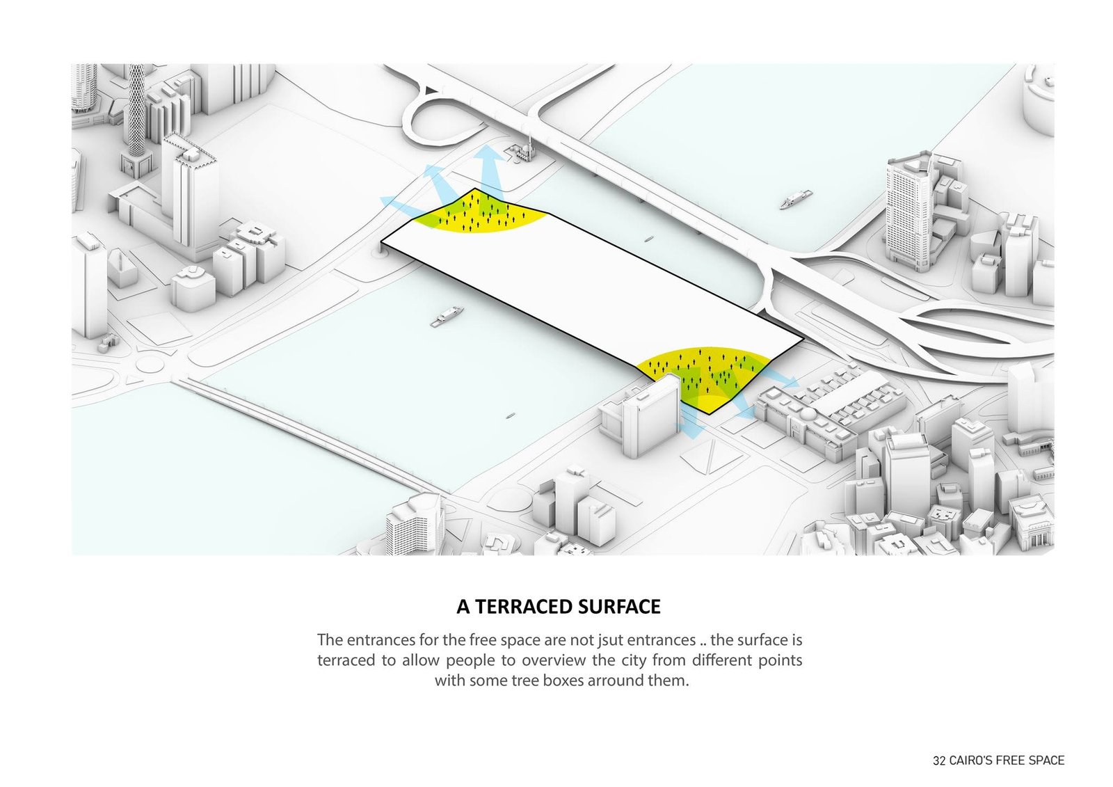
Terraced-surface diagram shaping entrances at the edges of the public platform.
Diagram showing circular paths within the public platform surface.
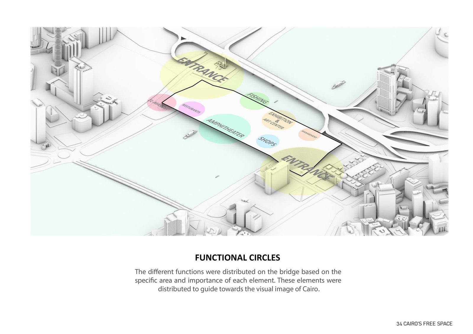
Functional-zoning diagram dividing the platform into coloured circular activity areas.
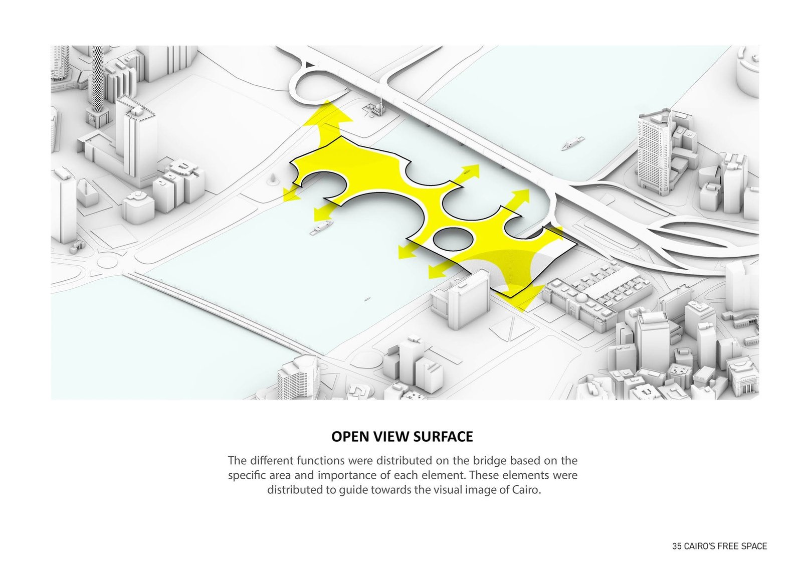
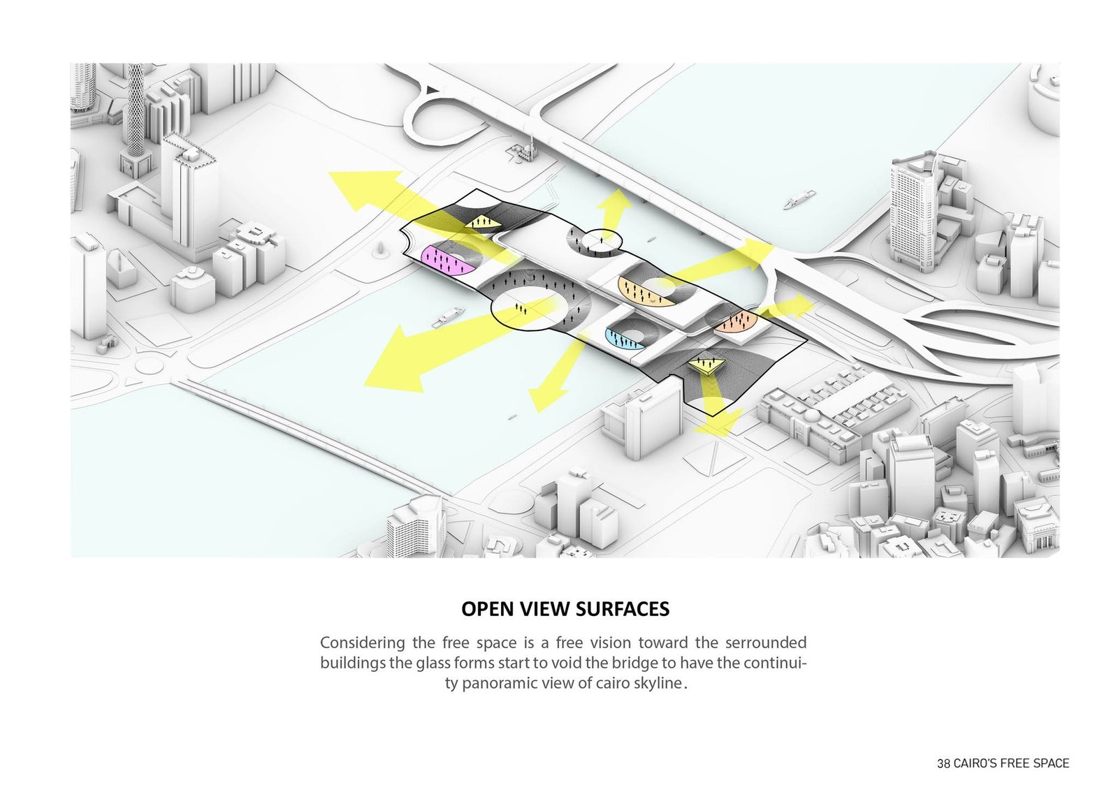
Open-view diagram showing circular openings and yellow sightline arrows.
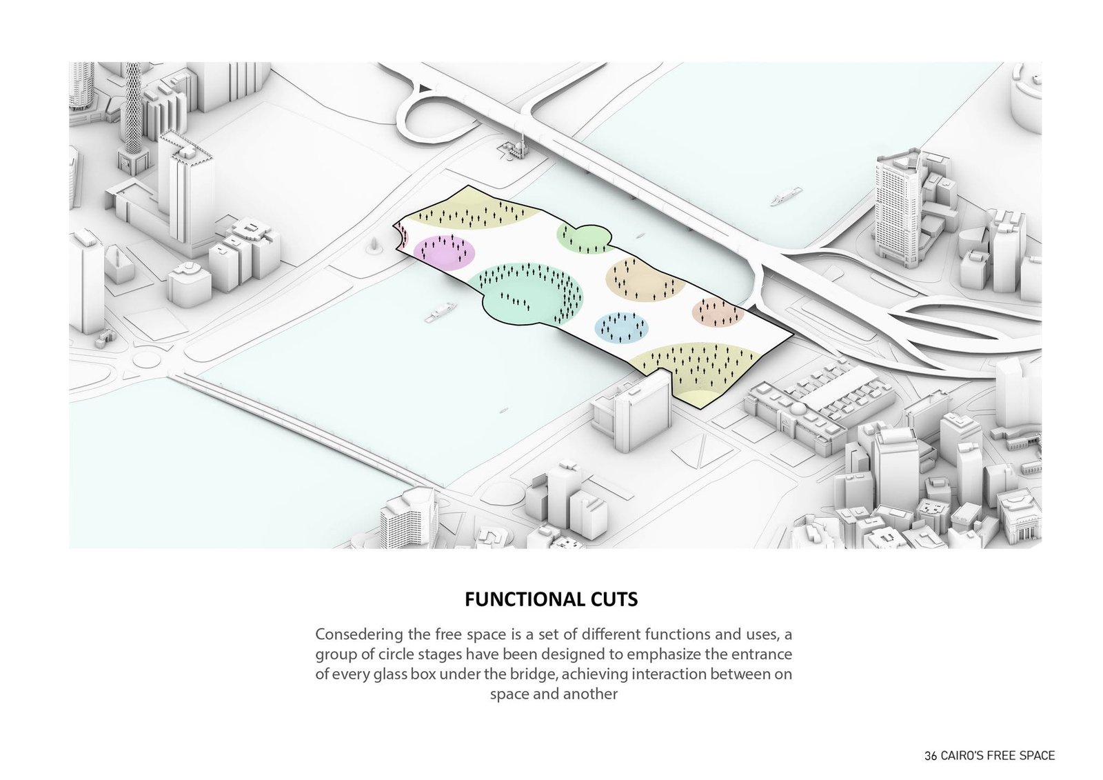
Functional-cuts diagram showing rounded openings within a coloured platform surface.
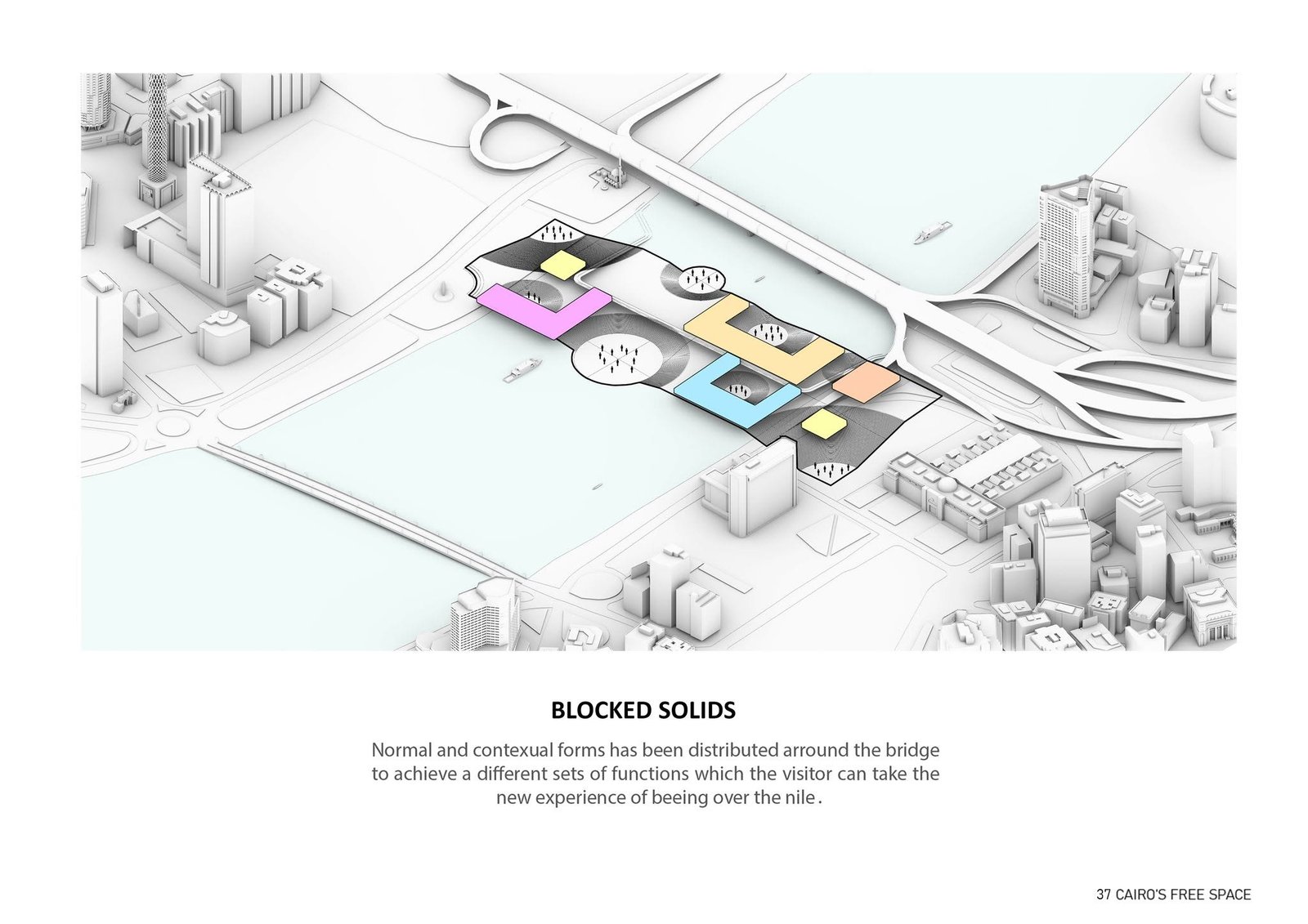
Massing diagram placing coloured solid volumes around the public platform openings.
View diagram showing openings, built volumes and arrows toward the surrounding city.
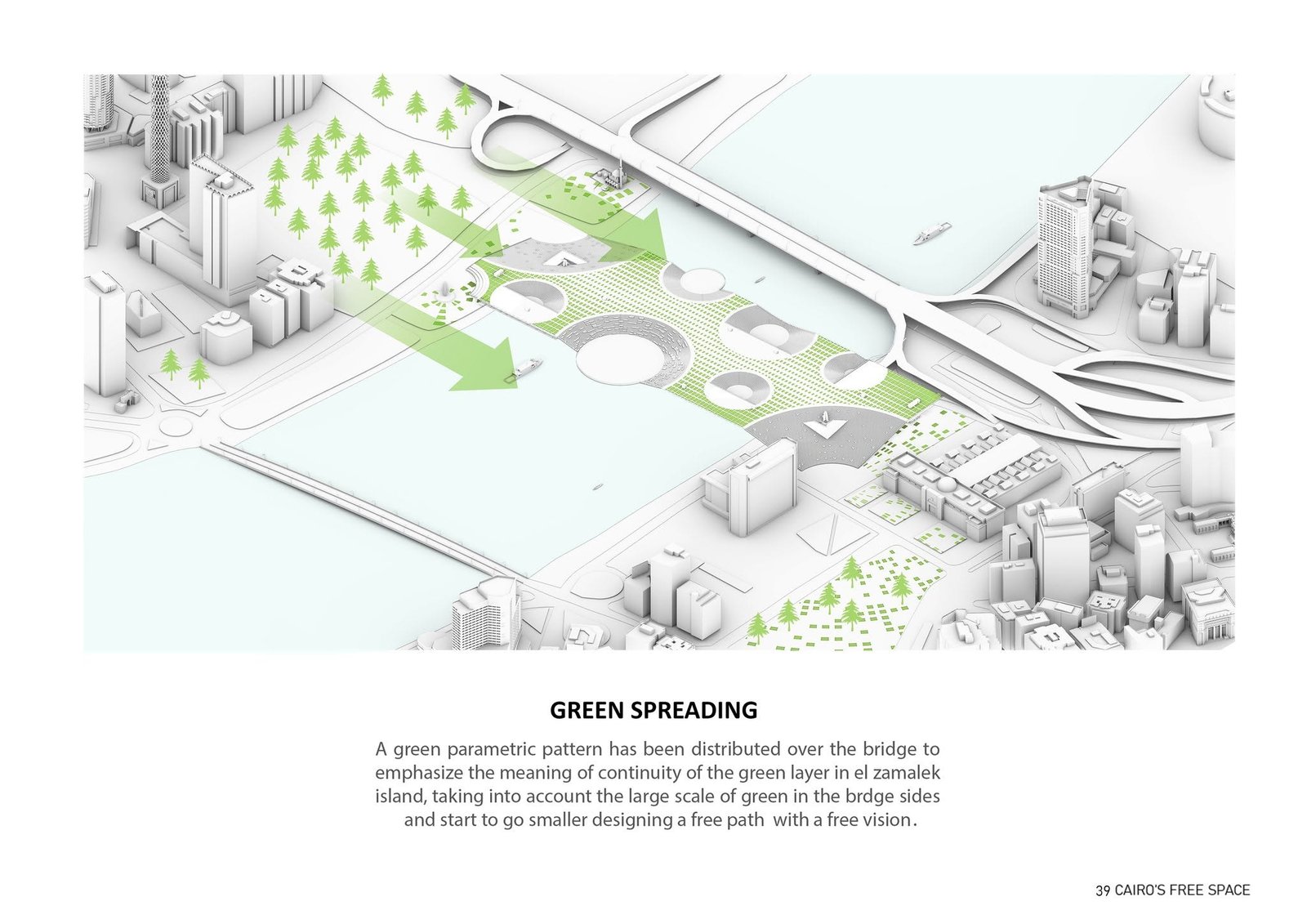
Landscape diagram spreading trees and green areas across the public platform.
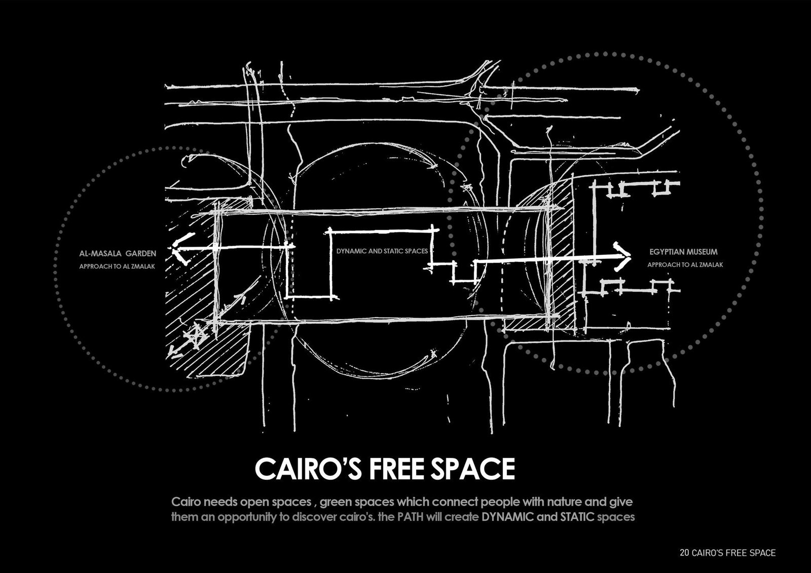
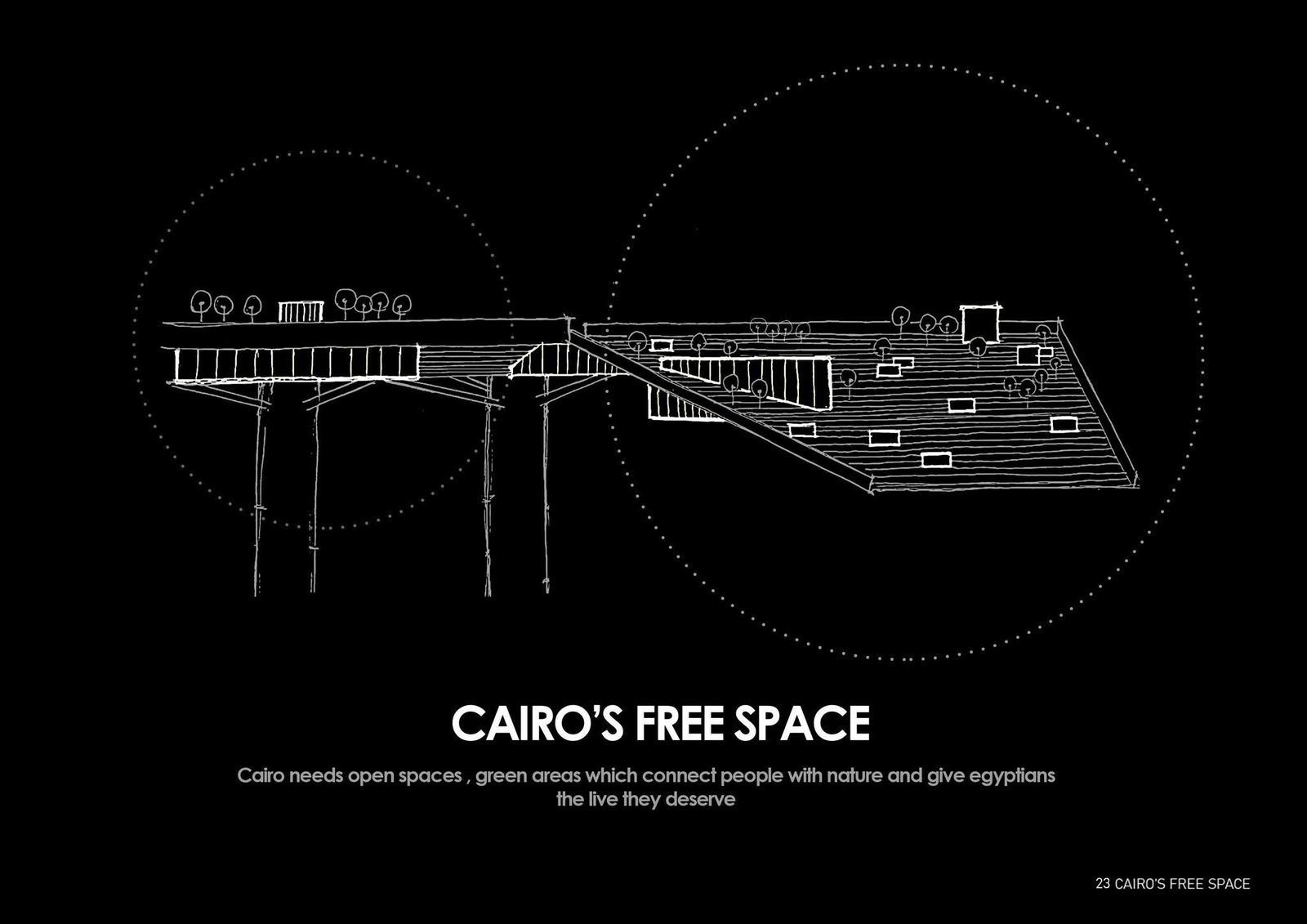
White-line concept sketch on black showing Cairo's Free Space and its cross-river connections.
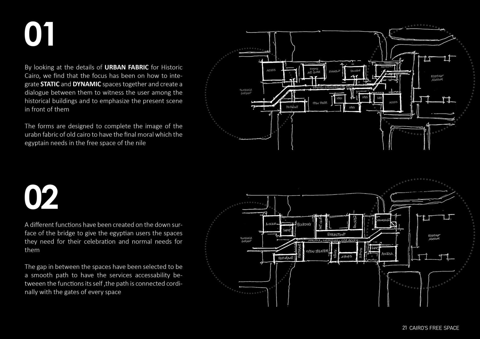
Paired white-line sketches illustrating the first two steps of the public-space concept.
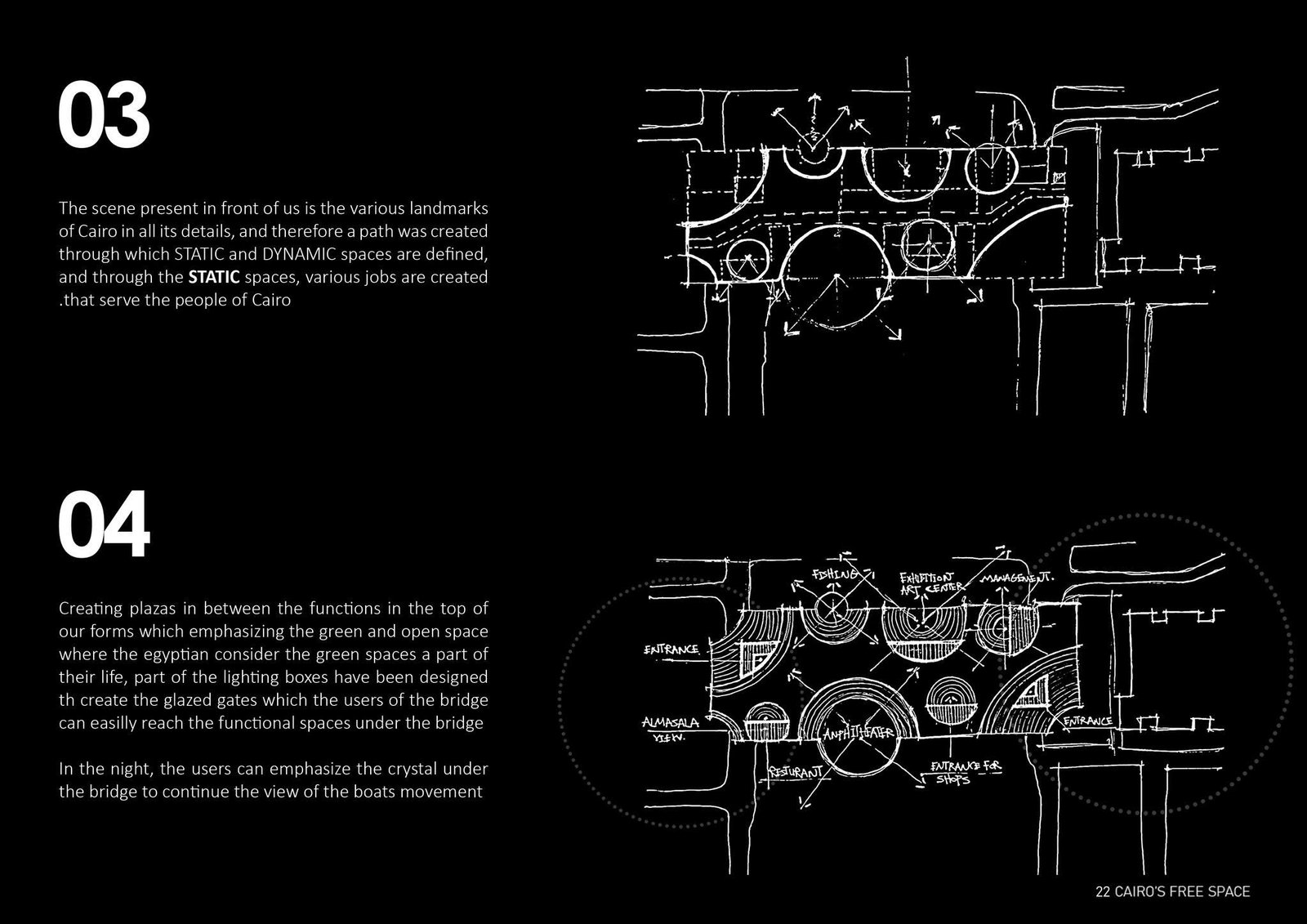
Paired concept sketches showing circular openings and gaps between platform functions.
White-line section sketch showing the relationship between the platform, river and city.
Architectural-drawings title slide for the Nile public-space proposal.
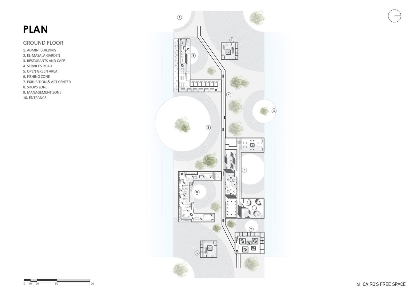
Ground-floor plan drawing showing rooms, circulation and circular landscape openings.
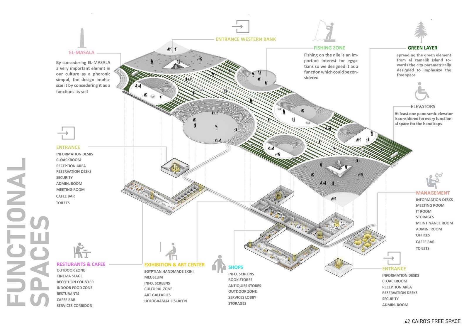
Exploded functional-spaces diagram showing the planted platform and lower building layers.
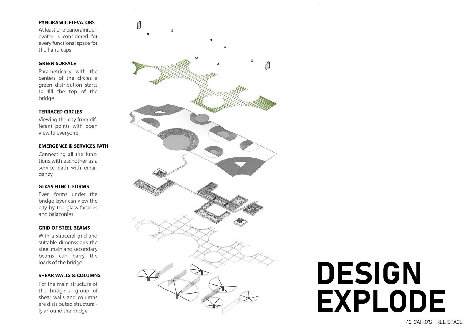
Exploded design diagram separating green areas, rooms, walls and structural grids.
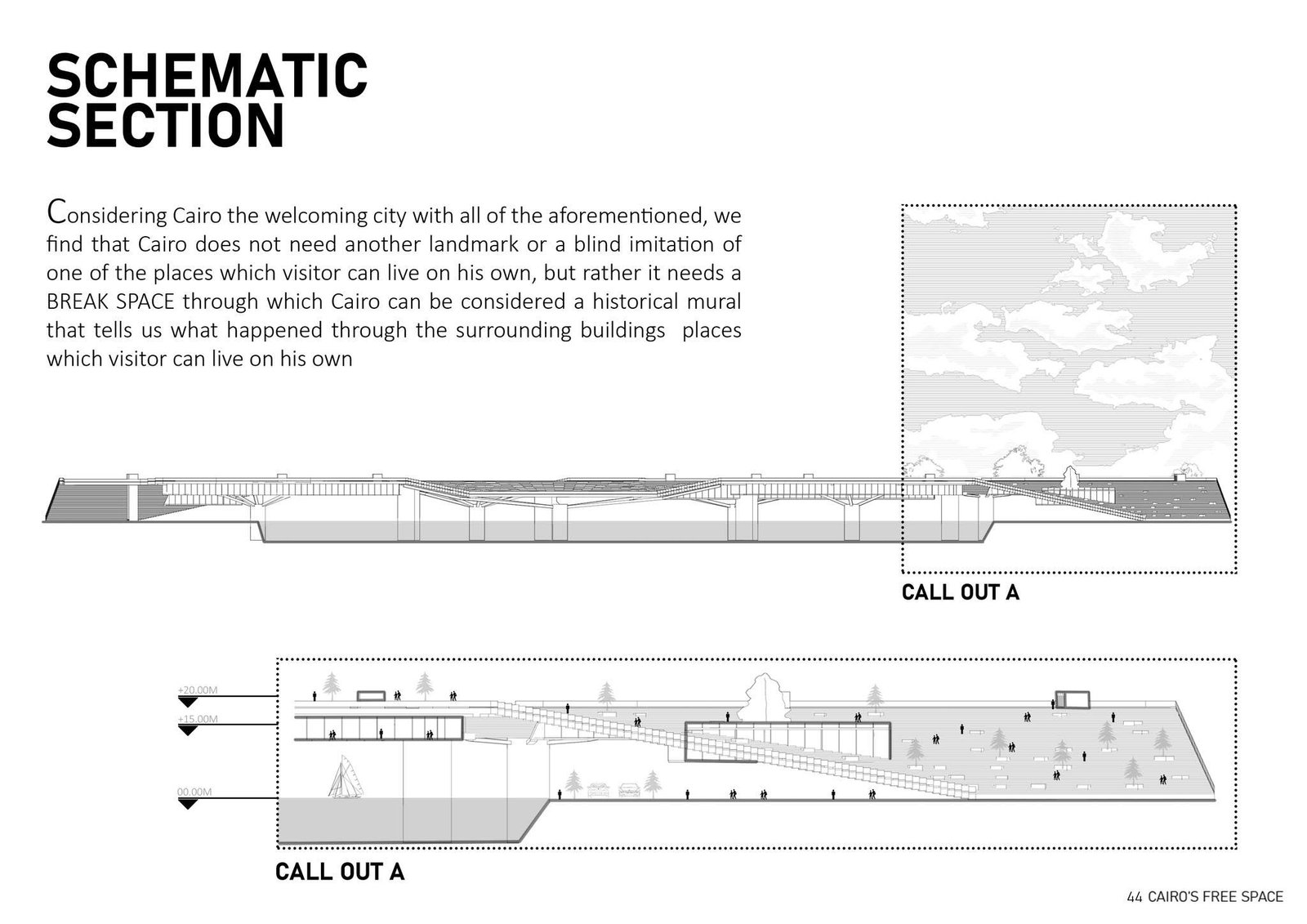
Schematic section drawings showing the platform, lower spaces and river level.
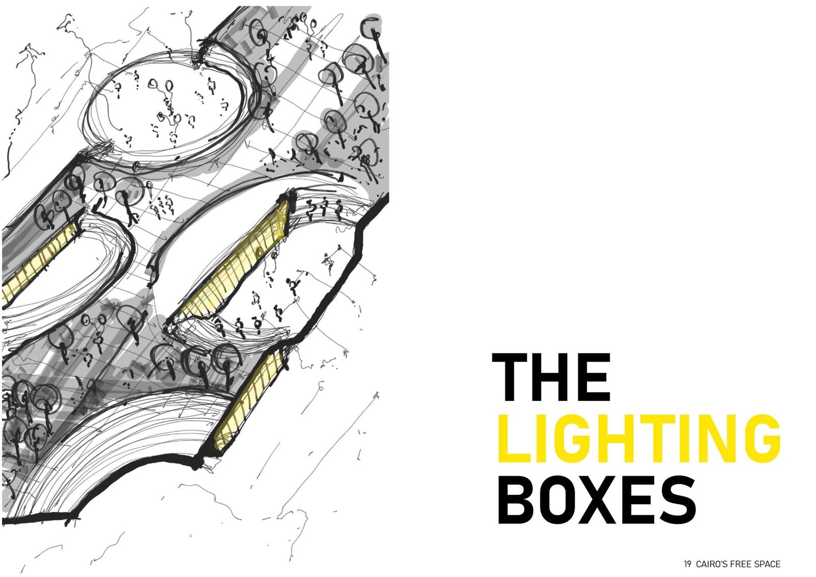
Hand-drawn architectural sketch showing the proposed lighting boxes.
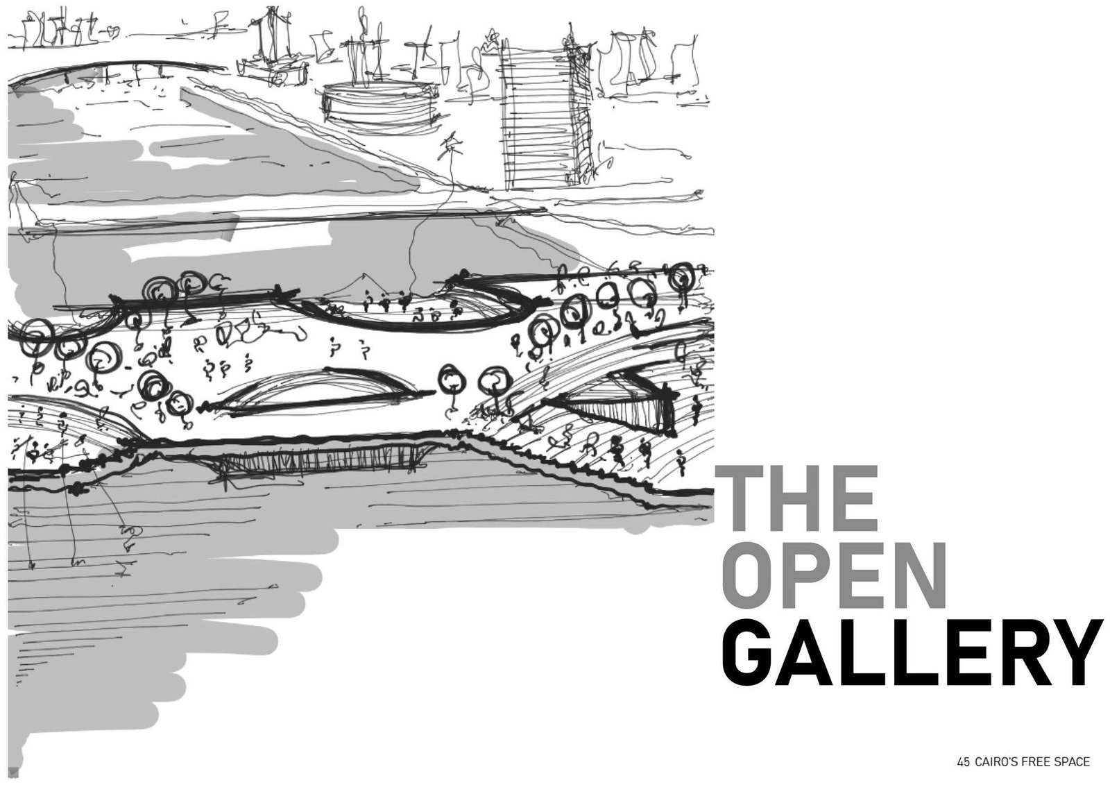
Hand-drawn perspective sketch showing an open gallery along the public platform.
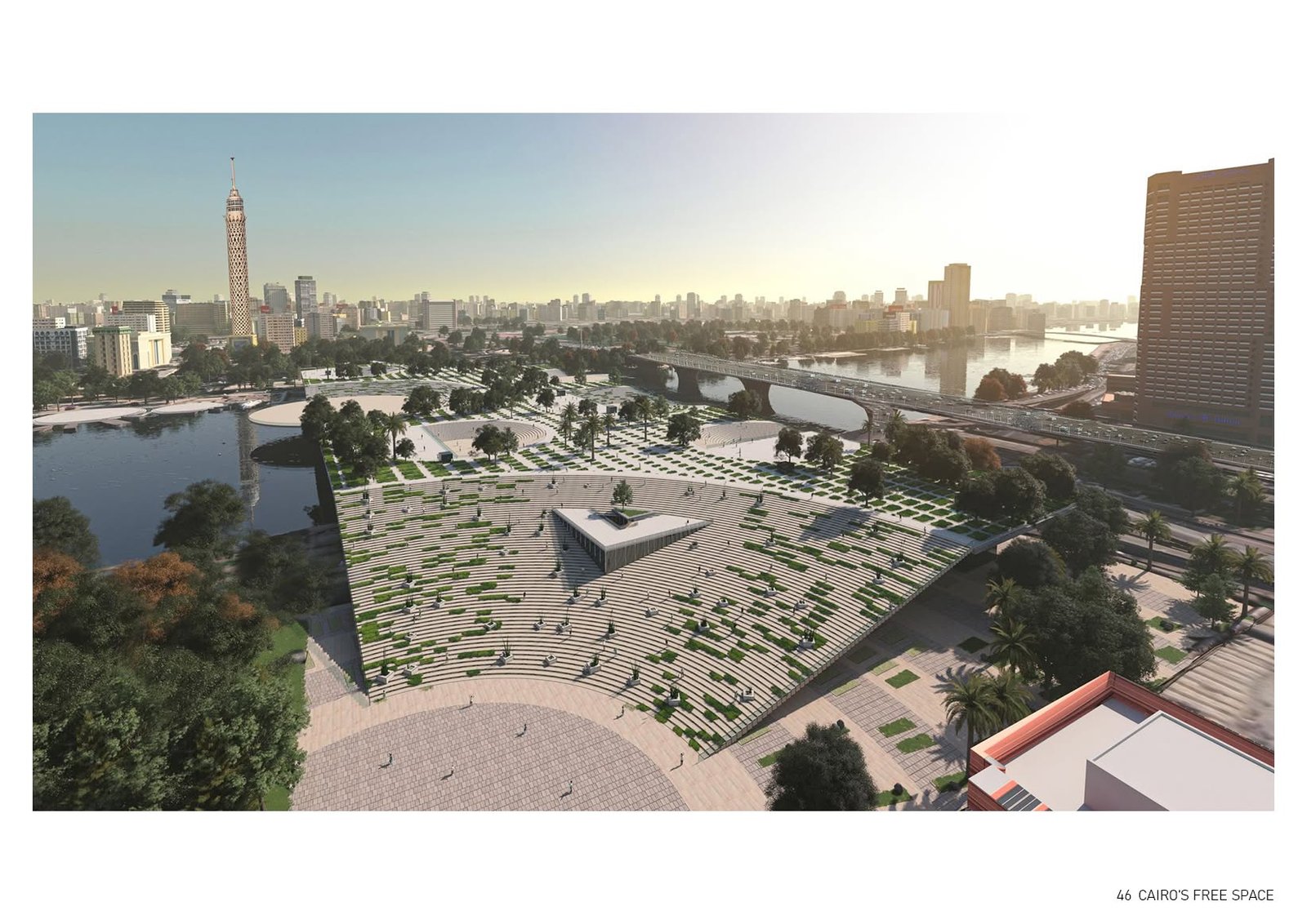
Aerial rendering of the planted public platform with the Nile and Cairo skyline beyond.
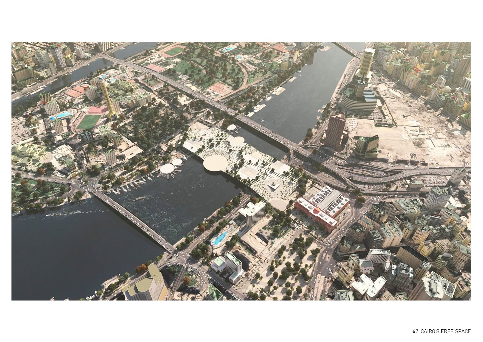
High aerial rendering showing the project across the Nile within the surrounding city.
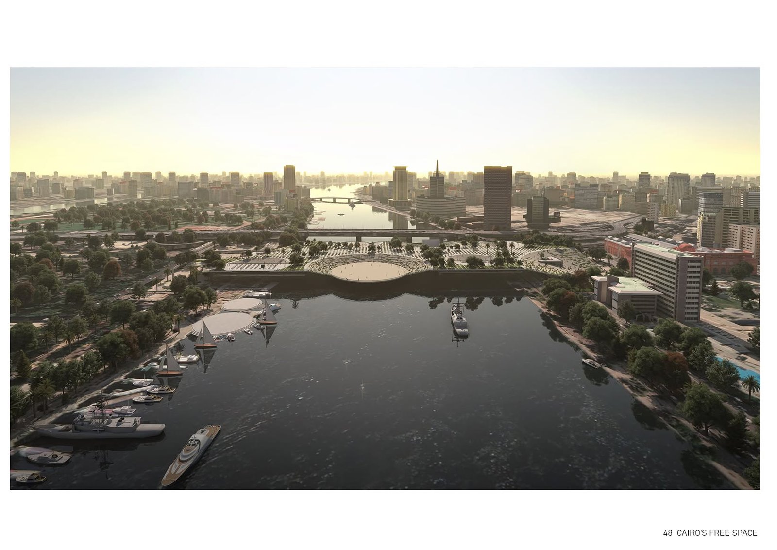
Sunset river rendering showing the public-space platform between the two Cairo riverbanks.
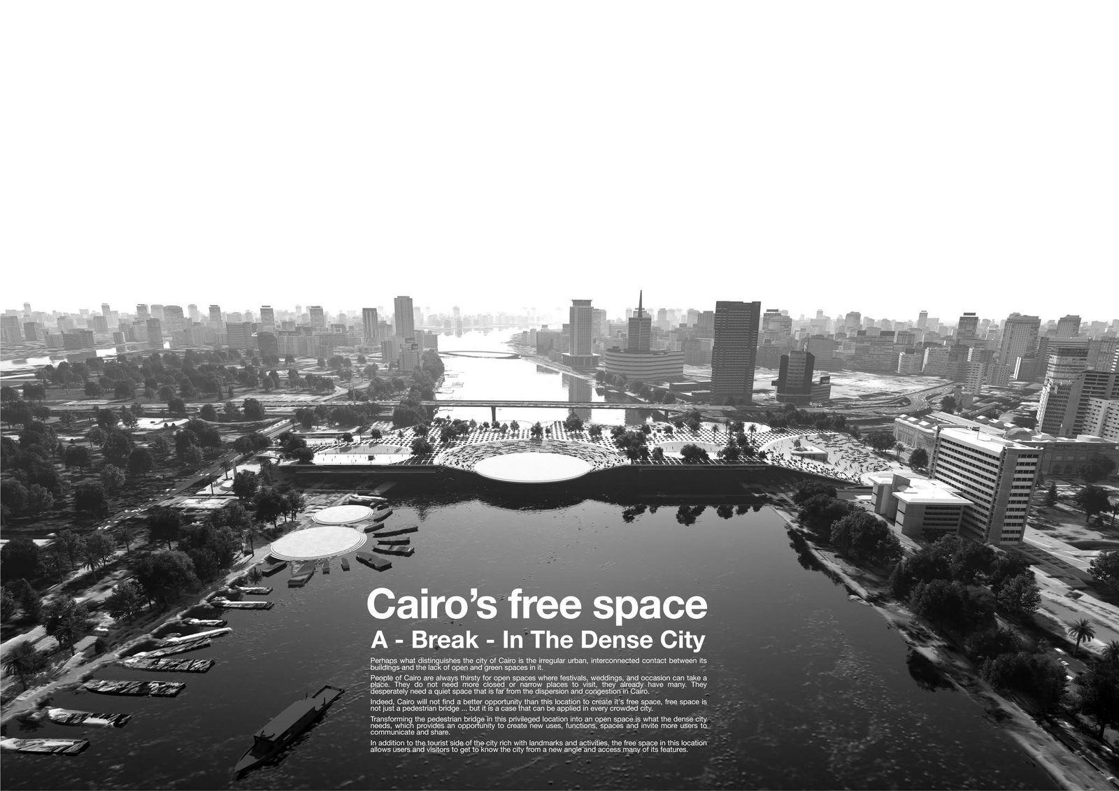
Black-and-white closing presentation image of Cairo's Free Space across the Nile.

Questions and answers

What is Cairo’s Free Space?

It is a 2020 architectural vision for a break space within Cairo’s dense urban fabric.

What does the concept mean by a historical mural?

It describes the surrounding buildings as an interwoven record through which Cairo’s cultures, histories and events can be understood.

How does the Nile relate to the vision?

The source uses the Nile as a central reference for Cairo’s history and for the diverse people who share the river’s urban setting.

Original Facebook description

Cairo's Free space A Break in the dense City, 2020 Vision When all these civilizations, cultures and history come together in one place and form an interwoven fabric of buildings to tell us what happened in this place. so you are in Cairo When we talk about Cairo, we must mention the Nile, which is the best witness to all those civilizations and the periods of time that passed through it, but it is the only source for documenting what happened in this place of civilizations, cultures and revolutions When we talk about the Nile, you find the Egyptians with different classes, religions, and ideas, and even the different reasons for visiting this place Considering Cairo the welcoming city with all of the aforementioned, we find that Cairo does not need another landmark or a blind imitation of one of the places which visitor can live on his own, but rather it needs a BREAK SPACE through which Cairo can be considered a historical mural that tells us what happened through the surrounding buildings.

View the original Facebook post